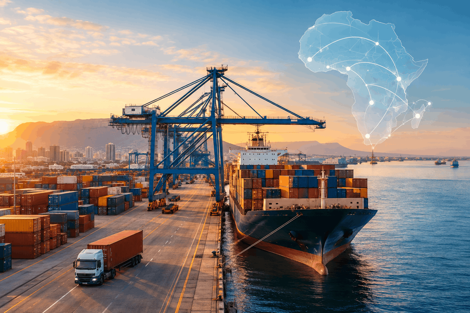
Explore Africa’s logistics networks, from Tanger Med and Suez to Lagos, Mombasa and Abidjan, and the infrastructure shaping trade across the continent.
What We’re Measuring
In this section
The article looks at Morocco, Egypt, South Africa, Djibouti and Ethiopia, Kenya, Côte d'Ivoire, and Nigeria.
When people talk about which countries matter most to African trade, the first thing they often look at is the size of the economy. That makes sense. A large economy usually creates a large demand for imported goods, while businesses need to move more raw materials, machinery and finished products in and out of the country.
But the size of an economy does not tell us how easily those goods actually move.
A country can have a huge domestic market and still struggle with congested ports, unreliable rail connections, slow customs processes or roads that cannot handle the volume of trucks coming through them. A much smaller country can have an outsized role in regional trade because its ports sit on an important shipping route or because neighbouring countries depend on its infrastructure to reach the sea.
Morocco is a useful example. Its economy is much smaller than Nigeria's, but Tanger Med sits on the Strait of Gibraltar, close to the maritime route connecting the Atlantic and Mediterranean. Its location gives it access to international shipping traffic, while Morocco's growing manufacturing sector, including its automotive industry, generates additional cargo for the port.
Nigeria shows a different side of the equation. Its enormous consumer market naturally attracts large volumes of imports through Lagos. But having a huge amount of cargo coming into a country does not, by itself, tell us how efficiently that cargo can move from the port to warehouses, factories, shops and other destinations.
So throughout this article, the question is not only how much trade a country handles. It is also how that trade moves, what infrastructure it depends on, and where the system begins to struggle.
The article looks at Morocco, Egypt, South Africa, Djibouti and Ethiopia, Kenya, Côte d'Ivoire, and Nigeria. Each brings a different piece of the picture. Morocco and Egypt are major gateways on some of the world's most important shipping routes. Djibouti's ports are closely tied to Ethiopia, a large landlocked economy that depends on access through neighbouring countries. Kenya serves not only its own market but also inland markets across East Africa. Côte d'Ivoire is an important gateway for several landlocked West African countries. South Africa has a large industrial economy and an extensive transport network, while Nigeria combines one of Africa's largest domestic markets with some of the continent's busiest ports.
There is also an important difference between how much cargo a port handles and how efficiently it operates.
A port can handle millions of containers every year because it serves a huge market, while still taking a long time to process individual ships. Another port may handle fewer containers but get ships through its terminals much faster. Looking only at cargo volume would miss that difference.
One measure used in this article is the Container Port Performance Index, or CPPI. It looks at how much time container ships spend in port and is designed to show how efficiently ports handle those vessels. In practical terms, it helps answer a question such as: once a container ship arrives, how long does it take to complete the port operation and leave again? A strong CPPI position therefore tells us something about port efficiency. It does not mean that the port handles the most cargo.
Then there is volume, which is usually measured in TEU, or twenty-foot equivalent units. A TEU is a standard unit for counting container capacity. A 20-foot container counts as one TEU, while a 40-foot container counts as two. This gives us a consistent way to compare container traffic even when ports handle different container sizes.
The article also uses the Logistics Performance Index, or LPI. Unlike the CPPI, which focuses on container-ship operations at ports, the LPI looks at the wider logistics system. It considers areas including customs, infrastructure, international shipments, logistics competence, tracking and tracing, and whether shipments arrive on time. It therefore tells us something about the conditions goods face after we move beyond the port itself.
The figures that follow cover several other measures as well: total cargo tonnage, port revenue, GDP, customs revenue, transit cargo, rail freight, debt payments and ship calls.
These numbers cannot be treated as interchangeable. A TEU figure tells us about container traffic. Tonnage tells us about the weight of cargo. CPPI tells us about how efficiently container ships are handled at a port. LPI looks at a much wider logistics system. Port revenue tells us about the financial value of maritime activity, while transit cargo can show how important a country's infrastructure is to trade going to neighbouring markets.
Putting these measures alongside one another gives us a fuller picture than any single ranking can provide. A country may have a huge economy but infrastructure that struggles under the volume of goods it generates. Another may have a relatively small domestic market but play a much larger role in regional trade because other countries depend on its ports, roads or railways.
That is the comparison this article will make: how much cargo is moving, how efficiently it moves, where it is going, and what the infrastructure reveals about each country's position in African trade.
PART ONE: MOROCCO | How Morocco Built a Major Trade Hub
The port was part of a much bigger plan
Morocco's logistics story begins with geography, but geography alone does not explain what happened next.
Tanger Med sits about 45 kilometres northeast of Tangier, directly opposite southern Spain across the Strait of Gibraltar. The strait is the narrow maritime passage connecting the Atlantic Ocean and the Mediterranean, so ships travelling between those two bodies of water already pass close to Morocco's northern coast.
Morocco began developing Tanger Med in the early 2000s, with the first port facilities opening in 2007. The idea was to turn that location into a major gateway for international shipping, transshipment and Moroccan exports.
That meant the port could not work in isolation. A container terminal is useful only when there are ships to serve, cargo to load and unload, roads and railways to move that cargo, and businesses close enough to the port to make use of the connection.
Morocco therefore developed an industrial and logistics zone around Tanger Med at the same time. Today, the wider Tanger Med industrial and logistics platform hosts more than 1,500 companies, with activity across automotive manufacturing, aeronautics, textiles, agribusiness and logistics.
That matters because it changes the way we should understand the port. Tanger Med is not only a place where containers arrive, change ships and leave again. It is also connected to factories producing goods for export. The port gives those companies access to international shipping, while the companies provide the port with cargo that originates in Morocco.
The automotive industry shows this particularly clearly. Renault and Stellantis operate manufacturing facilities in the surrounding region, creating a direct connection between industrial production and maritime export infrastructure.
Morocco was therefore building several parts of the system together: the port, the industrial zones, the transport connections and the businesses that would use them.
The numbers tell us how far it has grown
The scale of Tanger Med today would have been difficult to associate with a newly opened African port in 2007.
In 2024, Tanger Med handled 10,241,392 TEU, an 18.8% increase from the previous year. That made it the first African port to handle more than 10 million TEU in a single year.
Then it grew again.
In 2025, the port complex handled 11,106,164 TEU, an additional 8.4% increase. Tanger Med Port Authority attributed part of that growth to the opening of an extension to Terminal TC4, operated by APM Terminals.
TEU means twenty-foot equivalent unit, a standard way of measuring container traffic. It tells us how much container capacity passes through a port, rather than the physical weight of everything the port handles.
The tonnage figure gives us another view of the operation. Tanger Med handled 161 million tonnes of cargo in 2025, up 13.3% from the previous year. That included 8.6 million tonnes of liquid bulk cargo, mainly hydrocarbons, which increased by 13%.
So when we say Tanger Med handled more than 11 million TEU, we are talking specifically about container traffic. The 161 million tonne figure covers the wider port complex and includes other types of cargo as well.
Why so much of the container traffic is transshipment
A large part of Tanger Med's container business has nothing to do with goods being imported into Morocco or exported from Morocco.
This is called transshipment. A container arrives on one large ocean-going vessel, is transferred at the port onto another vessel, and continues to a different destination. The cargo may therefore pass through Morocco without ever entering the Moroccan market.
This is a crucial part of understanding Tanger Med's numbers. A port can handle enormous container volumes without all those containers representing domestic Moroccan trade.
Tanger Med has become an important transshipment point because ships travelling between major global routes can use the port to connect with other services. Smaller feeder vessels can then carry containers to and from other ports around the Mediterranean, West Africa and elsewhere.
At the same time, Tanger Med handles substantial Moroccan import and export cargo. Its role is therefore broader than transshipment alone.
The connection to Morocco's industrial economy is particularly visible in vehicle traffic. In 2025, the port's vehicle terminals handled 526,862 vehicles, including vehicles produced by the Renault and Stellantis plants in the surrounding industrial region.
Vehicle traffic actually fell by 12% in 2025, so the number should not be presented as evidence that vehicle handling was still growing. What it shows is the scale of the relationship between the port and Morocco's manufacturing base. Tanger Med is handling goods produced inside the country as well as cargo passing through the country on its way somewhere else.
Tanger Med's container figures therefore combine several kinds of trade: Moroccan imports and exports, transshipment between vessels, and cargo connected to the country's industrial economy.
Several different types of trade are taking place through the same infrastructure.
The shipping alliances have changed too
There is another piece of the story that needs to be kept current because the container shipping industry has been reorganising.
The 2M alliance, the long-standing partnership between Maersk and Mediterranean Shipping Company, ended in 2025. Maersk and Hapag-Lloyd subsequently began operating their new Gemini Cooperation, while other major carriers continued operating through their own networks and alliances.
Tanger Med became an important part of Gemini's network from February 2025, with the port serving as a major transshipment platform.
This matters because shipping alliances influence which ports become connection points in global container networks. When major carriers redesign their routes, a port can gain or lose services even if the port itself has not changed.
Tanger Med's position therefore depends partly on what Morocco has built around it and partly on how international shipping companies organise their networks.
More containers do not automatically mean greater efficiency
There is another number that complicates the picture.
Tanger Med's Container Port Performance Index, or CPPI, score was 135.8 in 2024, placing it fifth globally. Egypt's Port Said scored 137.4 and ranked third.
The CPPI measures the amount of time container ships spend in port. It is therefore concerned with how efficiently a port handles vessels and gets them through the port operation. It is not a measure of how many containers the port handles in a year.
Tanger Med's container volume increased sharply while its CPPI score moved slightly downward, from 139 in 2023 to 135.8 in 2024. The two figures are measuring different aspects of the port's performance.
The figures do not tell us that the increase in cargo caused the change in the CPPI score. They show that cargo volume and vessel-handling performance can move in different directions.
This is why Tanger Med's 11.1 million TEU in 2025 and its CPPI position answer different questions. The first tells us about the enormous amount of container traffic passing through the port. The second tells us about the time container ships spend being handled there.
Morocco is already planning for what comes next
The country's next major port project is Nador West Med, on Morocco's Mediterranean coast, roughly 380 kilometres east of Tanger Med.
It is sometimes described using the capacity figures from earlier masterplans, which outlined an initial container capacity of around 3 million TEU with room for expansion, alongside terminals for hydrocarbons, coal and general cargo.
The projects now under concession are more specific.
The Eastern Container Terminal has a full-capacity design of 3.4 million TEU. The Western Container Terminal, being developed through a partnership between CMA CGM and Marsa Maroc, is planned to become progressively operational from 2027 with annual capacity of 1.8 million TEU.
The distinction between planned capacity and operating capacity matters. These terminals are being built as part of Morocco's future port network, but their full designed capacity does not mean that those containers are already moving through Nador West Med today.
Nador West Med also gives Morocco another geographic option on the Mediterranean. Tanger Med sits at the entrance to the Mediterranean, while Nador is farther east along the Moroccan coast. Having two major port complexes serving different parts of the country's industrial and maritime network gives Morocco additional capacity as trade volumes change and shipping networks are reorganised.
Morocco's logistics story, then, is not just about having a port in a fortunate location. The country spent years building industrial activity, logistics facilities and maritime connections around that location. Tanger Med's numbers show what that strategy has produced so far, while Nador West Med shows that Morocco is still building for the next stage.
PART TWO: EGYPT | The Canal the World Depends On
Geography gives Egypt an extraordinary advantage
Egypt's position in global trade is difficult to understand without first looking at the map.
The Suez Canal connects the Mediterranean Sea to the Red Sea, giving ships travelling between Europe and Asia a much shorter route than sailing around the southern tip of Africa. For a container vessel travelling between major Asian and European ports, avoiding Suez means going around the Cape of Good Hope, adding at least 10 days to a voyage on average, according to UNCTAD.
That extra time means higher fuel consumption, longer journeys and vessels being tied up for longer. So when the Suez Canal is operating normally, it offers shipping companies a major time advantage.
UNCTAD estimated that around 12% to 15% of global trade passed through the Suez Canal in 2023.
For Egypt, that makes the canal an extraordinary economic asset. For global shipping, it makes the canal difficult to ignore.
But there is another side to having an infrastructure asset that so many international routes depend on. Egypt does not control everything that can affect whether ships use it.
Then the Red Sea became a problem
Beginning in late 2023, attacks on commercial shipping in the Red Sea led major shipping companies to reduce or suspend Suez transits and send vessels around the Cape of Good Hope instead.
The International Maritime Organization recorded 17 confirmed incidents involving commercial shipping between November 2023 and 9 January 2024.
The important point here is that the disruption did not begin with a failure of the Suez Canal itself. Ships were being diverted because of security risks on the approach to the canal through the Red Sea.
The effect on Egypt's finances was enormous.
Suez Canal revenue fell sharply, although the size of the decline looks different depending on which period we use.
Egypt's fiscal year runs from July to June. On that basis, Suez Canal revenue fell from $9.4 billion in FY2022/23 to $7.2 billion in FY2023/24, a decline of about 25%.
The calendar-year figures show an even steeper fall. Revenue reached a record $10.25 billion in 2023, before dropping to $3.991 billion in 2024, a decline of about 61%.
The number of vessels using the canal also fell dramatically. Ship transits dropped from 26,434 in 2023 to 13,213 in 2024, almost a 50% decline.
These are not estimates built from shipping-industry forecasts. They are figures reported by the Suez Canal Authority, which operates the waterway.
2025 did not bring the traffic back
After such a sharp fall in 2024, it would be easy to assume that traffic would begin returning as shipping companies became more comfortable using the route again.
The 2025 numbers show that the recovery was still incomplete.
The canal recorded 12,758 vessel transits in 2025, down from 13,213 in 2024. That was another 3.4% decline in the number of vessels. Net tonnage fell by a much smaller 0.5%, suggesting that the vessels using the canal were, on average, carrying substantial amounts of cargo even as the total number of transits remained low.
There were stronger signs of activity in parts of 2026, with the Suez Canal Authority reporting improved revenue during the early part of the year. But the 2025 figures remained well below the traffic levels Egypt had before the Red Sea disruption.
The canal therefore illustrates an unusual problem in logistics. Egypt can operate the infrastructure efficiently and still lose traffic because shipping companies decide that the route is too risky.
The port next to the canal tells a different story
There is another reason Egypt's logistics picture cannot be reduced to Suez Canal revenue.
The Suez Canal is a maritime passage. Port Said, at the northern entrance to the canal, is a container port. They are closely connected geographically, but they perform different functions.
Port Said actually performed strongly in the 2024 Container Port Performance Index. Its score of 137.4 placed it third globally, ahead of Tanger Med and made it the highest-ranked African port in that edition of the index.
The CPPI measures the time container ships spend in port. It therefore tells us about vessel-handling performance, rather than the amount of money Egypt earns from ships transiting the canal.
The figures can move in different directions because they measure different operations. With fewer ships using the Suez route during the Red Sea disruption, there was less pressure on some port operations. A port receiving fewer vessels can, under the right conditions, process those vessels more quickly.
Port Said's CPPI score describes how efficiently vessels were handled when they arrived. Suez Canal traffic describes how many vessels were choosing to use the route in the first place.
Egypt is still adding capacity
The disruption has not stopped investment in Egypt's port infrastructure.
At the Suez Canal Container Terminal in East Port Said, an expansion documented through IFC project materials adds 2.1 million TEU of container capacity, bringing the terminal's installed capacity to 6.6 million TEU.
That is capacity at a port terminal. It should not be confused with the number of vessels passing through the Suez Canal itself.
The wider Egyptian port system also appears across international performance measures. In the 2024 CPPI rankings, Port Said, Damietta, Alexandria, Dekheila and Ain Sokhna all appeared on the global leaderboard.
The following year's Lloyd's List ranking provides another perspective. Port Said ranked 53rd globally and Alexandria 90th in the 2025 Top 100 Container Ports ranking. For comparison, Morocco's Tanger Med ranked 17th and Togo's Lomé ranked 92nd.
Again, these rankings answer a different question from the Suez Canal's vessel and revenue figures. One looks at container-port activity and performance. The other tells us about ships choosing to use one of the world's major maritime shortcuts.
Egypt's exposure is tied to a decision made far beyond its borders
This is what makes Egypt's logistics position particularly exposed to events outside the country.
The value of the Suez Canal depends on shipping companies continuing to decide that the shorter route between Asia and Europe is worth using. When security conditions in the Red Sea changed, those companies were able to make a different decision. They could send their vessels around the Cape of Good Hope instead.
Egypt could continue operating the canal while traffic through it fell by almost half.
The infrastructure itself did not disappear. The geographic advantage did not disappear either. What changed was the willingness of shipping companies to use that route under the prevailing security conditions.
Egypt's experience therefore shows both the power and the vulnerability of geographic advantage. A country can sit on one of the world's most valuable trade routes, invest in ports around it and generate billions of dollars from ships passing through. But when the decision to use that route ultimately belongs to international carriers, events far beyond the country's borders can have an immediate effect on its trade and revenue.
PART THREE: SOUTH AFRICA | When a Strong Logistics System Hit Its Limits
A system that depended heavily on rail
South Africa entered the 2023 logistics crisis with one of the strongest logistics scores in Africa.
In the World Bank's 2023 Logistics Performance Index, South Africa ranked 19th out of 139 countries, with a score of 3.7. Nigeria ranked 88th with a score of 2.6.
The LPI looks at several parts of a country's logistics system, including customs, infrastructure, international shipments, logistics services, tracking and tracing, and the timeliness of deliveries. South Africa's position near the top of the global ranking therefore reflected a logistics system that, by this broad measure, compared well internationally.
Then the system came under severe pressure.
To understand why the disruption became so difficult to manage, it helps to look at how South Africa's freight network was designed.
A large part of the country's freight infrastructure is controlled by Transnet, the state-owned company responsible for the national freight rail network and major commercial ports. That creates a close operational connection between the railway and the ports.
Durban, South Africa's largest container port, was developed around a system in which significant amounts of freight could move between the port and the country's interior by rail. Richards Bay has a similar relationship with the rail network, particularly because of the large volumes of bulk commodities moving through the port.
The arrangement makes sense when the railway is working reliably. Cargo can move between the coast and inland production areas without putting every tonne onto a highway.
The problem comes when the railway loses capacity.
There is only so much cargo that can suddenly be transferred from rail to road. Roads have their own physical limits, and freight trucks require drivers, fuel, terminals and suitable routes. A disruption in the railway can therefore become a problem at the ports and on the highways at the same time.
That is what happened in 2023.
What Transnet said was going wrong
Transnet's own account of the crisis was unusually direct.
In November 2023, Transnet chairperson Andile Sangqu attributed the congestion to years of underinvestment in equipment and maintenance. He also warned that replacing major port equipment such as gantry cranes and ship-to-shore cranes could take 12 to 18 months.
There was an immediate operational problem as well. Transnet reported that adverse weather had caused 159 hours of lost production in October 2023 alone.
But weather was not presented as the underlying explanation for the wider crisis. The company linked the disruption to years of insufficient investment in the equipment and maintenance needed to keep the system operating at capacity.
The problem could not be fixed as quickly as a temporary weather disruption.
The backlog moved offshore
The effects were visible long before a container reached a warehouse.
At the height of the crisis, reports put the number of containers stranded on vessels waiting to enter Durban's container terminal at more than 70,000.
Those containers were not sitting inside the terminal. The ships carrying them were waiting offshore because they could not berth and unload their cargo.
Some reports described vessels waiting around 20 days or more to be processed. The 70,000-container figure was also described separately as equivalent to roughly nine days of cargo.
A statement that 70,000 containers were “stranded at Durban” does not mean 70,000 containers were physically sitting inside the terminal. A substantial part of the problem was that ships could not move through the terminal quickly enough.
The disruption also spread beyond Durban.
At Richards Bay, reduced rail capacity pushed more freight onto roads. The Road Freight Association described the resulting situation as chaos, with trucks queuing along the N2.
This is one of the clearest examples of how a problem in one part of a logistics network can appear somewhere else. When rail stops carrying the amount of freight it was designed to handle, the cargo does not disappear. It looks for another route.
In this case, that route was increasingly the road.
Shipping companies passed some of the cost on
The congestion also became more expensive for companies moving goods through South Africa.
MSC announced a $210-per-TEU congestion surcharge from December 3, 2023. Maersk introduced a separate congestion charge in the range of $200 to $400 per container.
These charges were commercial responses to the additional costs and delays associated with the disruption. They also meant that the consequences were no longer confined to Transnet or the companies directly using its terminals. Importers, exporters and other businesses using those shipping services could face higher transport costs.
The South African Association of Freight Forwarders estimated that the crisis was costing the economy as much as $6 million per day.
That figure should be treated as an industry estimate rather than as an independently verified government calculation. It nevertheless gives an indication of how the disruption was being valued by businesses working directly with the freight system.
Some shipping companies also changed their routes. During the worst of the delays, Maersk reportedly routed some smaller consignments through Mauritius before onward shipment to Cape Town, while some vessels bypassed Cape Town altogether.
Once carriers begin changing routes to avoid a congested port, the effects can spread beyond the original point of failure.
Fixing the equipment was never going to be immediate
Transnet's recovery programme included replacing and adding cargo-handling equipment at Durban's container terminals.
By February 2025, Transnet said more than 100 pieces of equipment were scheduled to be delivered during the 2025 calendar year, including four ship-to-shore cranes. Deliveries were scheduled to continue through December.
A ship-to-shore crane is the large piece of equipment that lifts containers between a vessel and the terminal. Without enough functioning cranes, a port can have enough physical space and still struggle to unload ships quickly.
The equipment shortage also shows why infrastructure crises can take longer to repair than they take to create.
A port can lose capacity very quickly when cranes fail, maintenance is delayed or railway volumes fall. Replacing the equipment is a different process. Large cranes and specialised cargo-handling machinery have to be manufactured, transported, installed and tested before they can begin handling commercial cargo.
So even after a decision has been made to fix the problem, the physical improvement may take months.
Some of the cargo found another route
South Africa's disruption also affected neighbouring logistics systems.
The Port of Maputo in Mozambique handled 31.2 million tonnes of cargo in 2023, a 16% increase from the previous year. Reporting at the time linked the increase partly to cargo being diverted from South African routes during the Transnet crisis, including mining-related flows.
Maputo's performance on the CPPI tells a different story. The port ranked 248th out of 348 ports in the 2022 index, but fell to 317th out of 405 ports in 2023.
The two figures should be read carefully because the number of ports included in the index changed between the editions. More importantly, the data do not prove that the additional cargo caused Maputo's lower relative CPPI position.
What they do show is that Maputo was handling substantially more cargo at a time when its position on a separate measure of port performance was weaker.
That is another useful reminder of why logistics cannot be understood through volume alone. When one country's transport system comes under pressure, neighbouring ports may receive some of the displaced cargo. But taking on additional freight can create its own operational pressures.
South Africa's 2023 crisis therefore travelled well beyond a queue of ships in Durban. A weakness in freight rail reduced the amount of cargo the network could move by rail. That increased pressure on roads and ports, created delays for ships, raised costs for shipping customers and encouraged some cargo to look for alternative routes through neighbouring countries.
The LPI score had described the broad quality of South Africa's logistics system. The 2023 crisis showed what could happen when one of the system's most important links could no longer carry the load expected of it.
PART FOUR: DJIBOUTI AND ETHIOPIA | One Gateway, Two Economies
Ethiopia's trade depends on a country with a much smaller economy
Djibouti and Ethiopia make more sense as a single logistics story because the two countries depend on each other in very different ways.
Ethiopia is one of Africa's largest landlocked economies. It has no coastline of its own, so goods entering or leaving the country by sea must first pass through another country's territory.
For decades, the main route has been through neighbouring Djibouti, whose ports sit on the Gulf of Aden at the entrance to the Red Sea. Goods can arrive at Djibouti's ports, move across the border into Ethiopia, and continue by road or rail towards Addis Ababa and other parts of the country.
For Ethiopia, Djibouti provides access to international maritime trade.
For Djibouti, Ethiopian trade provides the main source of demand for its port infrastructure.
The IMF estimates that about 95% of Djibouti's port activity is linked to Ethiopia. That is an unusually high level of dependence between two economies, and it explains why the infrastructure connecting the countries matters far beyond either country's borders.
A container arriving at a Djiboutian terminal may ultimately be destined for a factory, retailer or consumer hundreds of kilometres away in Ethiopia. The port is therefore only the beginning of the journey.
Being landlocked changes the economics of trade
A country without direct access to the sea has an additional logistical step that coastal economies do not have.
An Ethiopian importer cannot move a container directly from a domestic factory or warehouse to a seaport inside Ethiopia because there is no Ethiopian seaport. The cargo has to cross an international border before it reaches the ocean.
That creates costs and potential delays at several points: border crossings, customs procedures, roads, railways, transit agreements and the availability of transport services.
UNCTAD research has found that landlocked developing countries generally face higher trade costs than comparable coastal countries. The difference is influenced by much more than physical distance. Border procedures, transit arrangements, infrastructure and the quality of logistics services all affect how expensive and predictable the journey becomes.
Older UNCTAD research has documented cases in which landlocked developing countries faced trade costs up to 50% higher than coastal counterparts.
That figure should not be turned into a universal rule that Ethiopian goods cost 50% more to move, or that every landlocked African country faces exactly the same penalty. The point is that being landlocked creates additional logistical friction, and the quality of the corridor connecting a landlocked country to the sea can therefore have a direct effect on the cost and reliability of trade.
For Ethiopia, Djibouti is that corridor.
Djibouti built its economy around being that gateway
Djibouti's geography gives it a useful position of its own. It sits beside the Bab el-Mandeb Strait, the narrow passage connecting the Red Sea to the Gulf of Aden and the wider Indian Ocean.
That puts the country close to one of the world's major maritime routes. But Djibouti's port infrastructure has also been built around the much larger Ethiopian market immediately to its west.
The result is a logistics system in which the two economies are closely connected even though their economic structures are very different.
Djibouti is a small country. Ethiopia has a population and domestic market many times larger. Yet a substantial part of Djibouti's port infrastructure exists to serve Ethiopian trade.
That creates an obvious opportunity for Djibouti. The more trade Ethiopia generates, the more cargo can pass through Djibouti's ports.
It also creates exposure.
If Ethiopian trade volumes change, if Ethiopia develops alternative corridors, or if disruptions make the Djibouti route less attractive, Djibouti has a much smaller domestic market to fall back on.
The debt behind the infrastructure
There is another part of the story that is easier to miss when looking only at cargo volumes.
Djibouti invested heavily in the infrastructure needed to become a regional logistics hub. Those investments included the Addis Ababa–Djibouti railway, Doraleh port and other major infrastructure projects.
The projects expanded the country's ability to serve regional trade, but they also required substantial borrowing.
According to the IMF, Djibouti's debt-to-GDP ratio rose from 34.9% in 2013 to 68.9% in 2024. The increase was driven substantially by infrastructure investment, including projects connected to the country's role as a regional transport and logistics centre.
That gives us a clearer way to think about Djibouti's dependence on Ethiopian trade.
The country has invested heavily in infrastructure because that infrastructure gives it an economic role far larger than its domestic market would otherwise provide. But borrowing to build that infrastructure also means the country has to generate enough economic activity and government revenue to support the resulting debt.
The port relationship with Ethiopia is therefore not only about how many containers move through Djibouti. It is also connected to the financial commitments Djibouti made while building the infrastructure that makes the corridor possible.
The railway was supposed to make the corridor more efficient
The Addis Ababa–Djibouti Railway was built to strengthen the connection between Ethiopia's capital and Djibouti's ports.
Before the railway, much of Ethiopia's international freight travelled by road. A functioning railway offers another option for moving large quantities of cargo over a long distance, particularly heavy or relatively standardised freight.
In 2025, the railway carried around 3.2 million tonnes of freight, compared with approximately 1.8 million tonnes in 2024.
That is substantial growth in one year.
But the railway's reported freight volume is still well below its often-cited theoretical annual capacity of roughly 25 million tonnes.
The difference needs some context. A railway's design capacity is the maximum level it was engineered to handle under specified operating conditions. It is not necessarily the amount of freight the railway should be expected to carry every year, particularly while services, demand, rolling stock, maintenance and cross-border logistics systems are still developing.
The railway is carrying substantially more freight than a year earlier, while its current volume remains well below its theoretical annual capacity.
The more interesting question is what happens as Ethiopia's trade grows and as the corridor becomes more efficient. If more cargo can move reliably by rail, Djibouti's ports can potentially serve a larger Ethiopian market without every additional container or tonne of cargo putting equivalent pressure on the road network.
One corridor, two very different forms of dependence
The Djibouti-Ethiopia relationship ultimately comes down to a simple geographical fact with complicated economic consequences.
Ethiopia needs a reliable route to the sea. Djibouti has built much of its logistics economy around providing that route.
That gives Ethiopia access to international trade and gives Djibouti a role in trade far larger than the size of its domestic market would suggest. But it also means that infrastructure, debt and regional trade are closely connected.
For Ethiopia, the question is how efficiently and affordably goods can travel from its inland cities and industrial centres to the coast.
For Djibouti, the question is how much of that trade it can continue to attract and whether the infrastructure built to serve it can generate enough economic activity to justify the investment.
The railway sits between those two questions. Its growing freight volumes suggest that the corridor is being used more heavily, while the gap between current traffic and its theoretical capacity leaves considerable room for further growth.
PART FIVE: KENYA | The Corridor Serving More Than One Country
Mombasa is a gateway for the region
Kenya's logistics importance begins at the coast, but the cargo moving through Mombasa is not all destined for Kenya.
The port anchors what is known as the Northern Corridor, a transport network connecting the Kenyan coast with inland markets across East and Central Africa. The corridor runs through Kenya towards Uganda and provides connections onward to countries including Rwanda, Burundi and parts of the Democratic Republic of the Congo.
This is important because Uganda, Rwanda and Burundi are landlocked. Their businesses cannot send or receive maritime cargo directly through a domestic seaport. Goods arriving by ship therefore have to cross another country's territory before reaching their final destination.
For much of this regional trade, Mombasa has been that gateway.
A container arriving in Mombasa may eventually be headed for Nairobi, Kampala, Kigali or markets farther west. The port's importance is therefore partly a function of how much Kenyan trade it handles and partly a function of how many neighbouring economies depend on the same corridor.
That gives Kenya something that a purely domestic logistics system would not have: a customer base that extends beyond its own borders.
The railway was built to strengthen that connection
The Standard Gauge Railway, or SGR, was intended to make the movement of freight between Mombasa and inland Kenya faster and more predictable.
The first section opened in 2017, connecting Mombasa with Nairobi. The railway was later extended towards Naivasha, with the line reaching the Naivasha Inland Container Depot area around Suswa.
The Mombasa-Nairobi section is roughly 470 kilometres long, while the wider SGR network in Kenya extends to around 600 kilometres and beyond when subsequent sections are included. Its purpose was not simply to give passengers another way to travel. Freight was a major part of the project's rationale.
The basic idea is easy to understand. Instead of relying almost entirely on trucks to move containers away from Mombasa, cargo could be transferred onto trains and transported inland.
That can reduce pressure on highways and give importers another way to move large volumes of goods.
But building the railway required substantial borrowing.
China's Export-Import Bank of China financed roughly 90% of the project's approximately KSh566 billion cost. The loans subsequently became an important part of Kenya's public debt obligations.
The exchange rate turned a railway bill into a bigger one
There was another complication.
The original SGR loans were denominated in foreign currency, while Kenya's government raises most of its domestic revenue in Kenyan shillings.
That means the exchange rate matters.
If the shilling weakens against the currency in which a debt is denominated, the amount Kenya has to set aside in shillings to service that debt can rise even if the underlying foreign-currency amount has not changed.
In January 2024, reporting based on World Bank and Kenyan Treasury information put the increase in Kenya's SGR-related repayment obligation caused by exchange-rate movements at roughly KSh14 billion.
This is why the SGR financing became more than a question of how much the railway cost to build. The government also had to manage the cost of servicing the debt over many years while the value of the shilling moved against the currencies involved.
Kenya has since restructured part of the debt
The financing arrangement has changed since the original loans were signed.
Reported Treasury data showed that repayments to Chinese lenders reached KSh152.69 billion in the fiscal year ending June 2024, before falling to KSh107.74 billion in the fiscal year ending June 2026.
The reduction followed a restructuring of three dollar-denominated SGR loans. The revised arrangement converted the loans into renminbi, extended their maturities and provided additional grace periods. The restructuring also replaced floating dollar rates linked to the Secured Overnight Financing Rate with fixed renminbi rates of around 3%.
The result was a lower annual debt-service burden for Kenya.
The exact numbers are worth keeping separate from the broader story because the restructuring did not erase the debt. It changed the currency, repayment schedule and financing terms, giving Kenya more room to manage the payments over time.
Then there is the question of whether Kenya actually defaulted
The word default has been used in reporting about Kenya's SGR obligations, but the underlying arrangement is more complicated than that word suggests.
Kenya's Treasury records showed KSh167.5 billion in unpaid SGR-related on-lent loans during FY2023/24, with penalties reported in connection with the arrears.
Kenya Railways, however, disputed descriptions of this as a direct default to China Exim Bank. Its position was that the railway company had a separate on-lending agreement with Kenya's National Treasury, and that this agreement was distinct from the underlying financing facility between the Kenyan government and China Exim Bank.
So there are two different relationships involved: the original external loan and the domestic on-lending arrangement through which the Kenyan government passed the financing obligations on to Kenya Railways.
The safest way to describe the episode is therefore to refer to unpaid SGR-related on-lent obligations and the dispute over whether those obligations should be characterised as a direct default to China Exim Bank.
The railway also has to connect to the countries beyond Kenya
The SGR was designed to strengthen Mombasa's position as a regional gateway, but a regional corridor is only as useful as its connections across borders.
Uganda has been developing plans for its own Standard Gauge Railway, and questions have emerged over whether its preferred technical configuration will work seamlessly with Kenya's existing system.
Kenya's railway uses the Chinese-standard system associated with the wider East African SGR projects. Uganda has considered a different configuration based on European standards.
That creates a technical problem because railways do not become interoperable just because tracks from two countries eventually meet. Differences in signalling, electrification, track systems, locomotives, operating rules and other technical standards can affect whether trains can cross the border without transferring cargo or changing equipment.
The two governments have therefore discussed technical and policy measures intended to make cross-border operations possible.
What has not happened is a complete exclusion of Kenyan locomotives from Uganda. The interoperability question remains unresolved, and the eventual design of Uganda's railway will determine how easily the two systems can work together.
Tanzania offers another possible route
There is also another development worth watching, although it should not be confused with an operating alternative today.
In February 2026, Reuters reported that Uganda was planning to connect its proposed SGR to Tanzania's railway network, creating a possible route from Uganda towards the port of Dar es Salaam.
If developed, that would give Uganda another maritime corridor.
For Kenya, the significance would be straightforward. Mombasa would no longer be the only major coastal gateway competing for Uganda-bound freight.
The Tanzania connection is still at the planning and development stage. It is not currently moving Ugandan freight at the scale of the Northern Corridor.
Kenya's position therefore rests partly on infrastructure that already exists and partly on how well that infrastructure connects to the markets beyond Kenya.
Mombasa has the port. The Northern Corridor provides the road and rail connection inland. The SGR was built to strengthen that connection, but its financing has created long-term public obligations, while questions over cross-border railway standards could affect how far the network can extend.
At the same time, Uganda is looking at alternatives.
For Kenya, that means the future of Mombasa as a regional gateway will depend on more than what happens inside the port itself. It will also depend on the cost, reliability and connectivity of the corridor that carries cargo from the coast to the inland markets that use it.
PART SIX: CÔTE D'IVOIRE | How Abidjan Became a Gateway for West Africa
Abidjan's importance extends beyond Côte d'Ivoire
The Port of Abidjan is one of West Africa's principal maritime gateways, but its importance cannot be measured by the cargo that belongs to Côte d'Ivoire alone.
The port also serves trade moving towards countries that do not have a coastline of their own, particularly Burkina Faso and Mali. Goods can arrive by sea at Abidjan and then continue north by road towards inland markets.
That makes the port part of a much larger transport corridor.
A container arriving in Abidjan might be carrying goods for an Ivorian business in Abidjan or an importer hundreds of kilometres away in a landlocked country. The same roads and logistics facilities therefore have to serve both domestic trade and regional transit traffic.
Claims about exactly how much of each neighbouring country's foreign trade passes through Abidjan need to be treated carefully. Older regional estimates are sometimes presented as though they mean that most of Burkina Faso's, Mali's, Niger's, Chad's or Guinea's external trade individually passes through Abidjan. The available evidence does not support such a broad current claim.
What can be established more comfortably is that Abidjan is an important gateway for Côte d'Ivoire and a significant route for trade moving to landlocked countries in the region.
Its importance is therefore regional without requiring us to attach an unsupported percentage to every neighbouring country.
The port is deeply connected to Côte d'Ivoire's economy
Abidjan's role is also much larger than the container terminal itself.
Ivorian government figures have historically estimated that activity connected to the port accounts for around 90% of customs revenue and 60% of state income, while around 70% of national GDP passes through the port.
These figures are widely cited and have been associated with material from Côte d'Ivoire's Ministry of Economy and Finance. They should, however, be understood as historical institutional estimates rather than measurements of the country's economy in 2026.
The underlying point remains clear even without treating those percentages as current-year statistics: Abidjan is deeply embedded in Côte d'Ivoire's economy.
The port handles imports needed by businesses and consumers, exports produced in the country, and goods moving onward to inland markets.
That concentration has helped make Abidjan an important commercial centre. It also creates a question that becomes more important as traffic grows: what happens when too much of the country's logistics activity has to pass through one place?
Côte d'Ivoire has been adding capacity
One answer has been to expand the port itself.
The Côte d'Ivoire Terminal, developed as a joint venture between Africa Global Logistics and APM Terminals at a cost of roughly $400 million, began commercial operations in November 2022.
The terminal added 1.5 million TEU of annual container capacity, bringing the port's overall capacity to around 2.5 million TEU. It also has a 16-metre draft, allowing it to accommodate larger container vessels than older facilities with shallower access.
A deeper draft is particularly useful in container shipping because larger ships generally require more water beneath them. The terminal therefore gives Abidjan greater capacity to handle modern container vessels and larger volumes of cargo.
It is worth being precise about what this means. Côte d'Ivoire Terminal is a major deepwater facility on the West African coast, but it is not the only deepwater container facility in the region. Lomé in Togo, for example, also has deepwater container infrastructure.
The significance of the investment is therefore its contribution to Abidjan's capacity rather than any claim that it is uniquely the region's deepest or largest facility.
The traffic suggests the corridor is still being used
The more revealing test of Abidjan's regional role is what happens to cargo moving towards its landlocked neighbours.
In 2025, transit traffic to landlocked countries through Abidjan reached 3.92 million tonnes, an increase of 34.1% from the previous year.
The individual country figures are also notable.
Transit traffic to Burkina Faso increased from 2,214,648 tonnes in 2023 to 2,400,111 tonnes in 2025.
Traffic destined for Mali increased much more sharply, rising from 835,216 tonnes in 2024 to around 1.47 million tonnes in 2025, an increase of approximately 76.4%.
These figures are particularly interesting because both Mali and Burkina Faso have experienced significant political instability in recent years.
Ivorian port authorities have interpreted the continued and growing traffic as evidence that Malian operators continue to have confidence in the Abidjan corridor. That is the port authorities' interpretation of the figures, rather than something the traffic data can prove by themselves.
The numbers do, however, establish something concrete: cargo continued moving through Abidjan towards these markets, and the volume increased substantially in 2025.
That tells us something about the practical importance of an established trade corridor. Political relationships can change, security conditions can deteriorate and governments can pursue alternative routes, but businesses still need to move physical goods.
A functioning port and established transport connections can therefore remain valuable even when the wider political environment is difficult.
The problem is what happens after the port
Abidjan's success has created another logistical challenge.
Africa Global Logistics, which operates major logistics facilities connected to the port, has acknowledged the problem of excessive concentration. Its description was blunt: “everything converges on the port.”
That is an important admission because increasing port capacity does not automatically solve congestion elsewhere in the system.
Imagine a port capable of receiving more containers, but with most of those containers still needing to leave through the same roads, warehouses and inland distribution points. The port may be able to unload ships faster while trucks and inland facilities struggle to absorb the additional cargo.
The response has therefore started moving beyond the waterfront.
Africa Global Logistics announced plans for more than $67 million in inland logistics investment over five years, including decentralised logistics hubs in Ferkessédougou, Bouaké and San Pédro.
The idea is to distribute some logistics activity across the country rather than requiring so much cargo to pass through Abidjan before continuing towards its final destination.
Ferkessédougou is particularly relevant to the northern corridor, given its proximity to trade routes serving Burkina Faso and Mali. Bouaké sits further inland and is already an important commercial centre, while San Pédro provides another major port option on Côte d'Ivoire's southern coast.
The strategy is therefore moving in two directions at once: expand the gateway at Abidjan while building more logistics capacity away from the gateway itself.
Abidjan's next test is regional, but also domestic
Côte d'Ivoire has built a port system that serves two markets at the same time. It serves its own economy and provides a route to the sea for neighbouring countries that do not have one.
That regional role helps explain why Abidjan continues to handle significant transit traffic even as conditions in some neighbouring countries become more difficult.
But the same success creates pressure. When large amounts of cargo converge on one port, the challenge eventually becomes bigger than the port's ability to unload ships. Roads, inland depots, warehouses, customs processes and distribution centres all have to absorb what leaves the terminal.
Côte d'Ivoire is now investing in those inland connections as well.
The next stage of Abidjan's development is therefore less about proving that the port can attract cargo. The 2025 figures already show that it can. The harder question is how efficiently that cargo can move beyond Abidjan and reach the markets that depend on the corridor.
PART SEVEN: NIGERIA | The Largest Economy, and What Market Size Cannot Solve
A huge market can still have a difficult logistics system
Nigeria is Africa’s most populous country and one of the continent's largest economies. It has an enormous domestic market, a large consumer base and a volume of imports and exports that gives its ports plenty of potential traffic.
Yet the size of that market has not automatically translated into an efficient logistics system.
The World Bank’s 2023 Logistics Performance Index, which compares countries across customs, infrastructure, international shipments, logistics competence, tracking and tracing, and timeliness, ranked Nigeria 88th out of 139 countries, with a score of 2.6.
That placed Nigeria behind several considerably smaller economies, including Benin, Namibia, Rwanda and Djibouti.
The comparison is useful because it separates two things that are often treated as though they are the same: how much economic activity a country has, and how efficiently its logistics system can support that activity.
Nigeria has the market. The harder question is how easily goods can move through the infrastructure serving that market.
The port problem is concentrated in Lagos
Nigeria has a much larger port system than the congestion around Lagos sometimes makes it appear.
Before Lekki Deep Sea Port opened, the country's principal seaport system comprised six major port complexes: Apapa and Tin Can Island in Lagos, Calabar in Cross River State, the Rivers ports and Onne in Rivers State, and Warri in Delta State.
These ports do not all handle the same cargo, operate at the same scale or experience the same level of congestion.
The most persistent bottlenecks have been concentrated around Apapa and Tin Can Island, which sit inside Lagos, Nigeria's largest commercial centre and one of its most important consumption markets.
That concentration creates a particular problem. When cargo is discharged at a Lagos port, the journey is not finished. Containers still have to leave the terminal, move through the surrounding road network, pass through truck and terminal processes, and eventually reach warehouses, factories, distribution centres or customers.
A port can therefore have adequate berthing infrastructure and still experience serious logistics problems if the land-side system cannot absorb the cargo efficiently.
This is one reason Nigeria's port challenge cannot be understood by looking only at cranes, berths or container-handling capacity.
The cost of congestion depends on what is being measured
There are several widely cited estimates of what Nigerian port congestion costs the economy. They are useful indicators of scale, but they should not be stacked together as though they measure the same loss.
The African Centre for Supply Chain has published an estimate that Nigeria loses approximately $14.2 billion annually because of bottlenecks at Apapa and Tin Can Island. That is an industry estimate, rather than a figure recorded in Nigeria's national accounts.
A 2020 Dynamar estimate put the economic cost of port congestion at approximately $55 million per day. The date is important. That was an estimate for 2020, not a current measurement of daily losses in 2026.
The Lagos Chamber of Commerce and Industry has also been widely cited for an estimate of roughly ₦2.5 trillion in annual losses associated with port congestion. That figure dates back to 2018, although later reports have cited similar numbers using different approaches.
These figures should therefore be read as different attempts to quantify the economic consequences of congestion. They come from different years, institutions and methodologies. Some focus on direct business costs, while others attempt to capture broader economic effects.
These figures cannot be added together because they refer to different years, methodologies and types of economic loss.
Taken separately, they show that congestion around Nigeria's major commercial ports has been treated as a substantial economic problem for years.
Lekki was designed to add another option
Lekki Deep Sea Port was developed partly in response to the limitations of Nigeria's existing port infrastructure.
The port received its first commercial vessel on April 6, 2023, marking the beginning of commercial operations. It was designed as a deep-water facility with a 16.5-metre draft, allowing it to accommodate larger vessels than many existing Nigerian port facilities.
Its container capacity also needs to be described carefully.
Phase 1 has a capacity of around 1.2 million TEU annually, while the port has been planned for expansion toward approximately 2.5 million TEU.
TEU means twenty-foot equivalent unit. It is the standard measure used to describe container capacity, with a standard 20-foot container counting as one TEU and a 40-foot container counting as two.
The 2.5 million figure therefore should not be read as the amount Lekki is currently handling every year. It represents the larger capacity envisaged as the port develops.
Lekki also introduced automated cargo-handling systems and deeper-water access into Nigeria's port network. In theory, that gives importers, exporters and shipping lines another route into one of Africa's largest consumer markets.
But a container does not create economic value simply because a ship has unloaded it.
It still has to leave the terminal.
The 2026 congestion shows where the next bottleneck can appear
Events around Lekki in 2026 have provided a useful example of what happens after a port adds physical capacity.
In September 2026, discussions involving Lagos State and stakeholders identified several problems affecting movement along the Lekki-Epe corridor. These included unauthorised truck access, trucks being unable to leave bonded terminals after 6pm, deficiencies in the Epe electronic call-up system and heavy vehicles parking indiscriminately along access routes.
These are not problems with the depth of the harbour.
They are problems involving truck management, enforcement, terminal access, road capacity and traffic coordination.
A ship can be handled efficiently at the quay while the container waits much longer before it reaches its final destination.
The September 2026 episode provides current evidence of a narrower problem: Nigeria can add modern port infrastructure while still facing serious constraints in the systems connecting that infrastructure to the wider economy. Those constraints include truck management, road access, terminal operations, cargo evacuation and institutional coordination.
Port capacity and cargo evacuation are two different parts of the same journey.
The market is already finding alternatives
There is another way to see the consequences of Lagos congestion: look beyond Nigeria's borders and follow where some cargo is going.
A French Treasury analysis has highlighted the diversion of cargo toward neighbouring Benin and Togo, arguing that chronic congestion in Lagos has encouraged some Nigerian-bound trade to use alternative regional gateways.
The analysis cited an estimate that approximately 90% of the cargo arriving at the ports of Cotonou and Lomé is ultimately destined for Nigeria.
That is a specific estimate from a specific analysis, rather than a figure that should be treated as independently verified for every shipment moving through those ports.
But the underlying commercial behaviour is important.
A Nigerian importer does not necessarily have to bring every container directly through a Nigerian seaport. If another port can receive the cargo and the inland journey into Nigeria is sufficiently reliable or economical, the regional logistics network can route around the bottleneck.
Benin's Port of Cotonou and Togo's Port of Lomé therefore form part of the competitive environment surrounding Nigerian trade.
This is where Nigeria's enormous market size becomes particularly revealing.
The market itself can attract cargo. But shipping lines, importers and logistics companies also have to consider the cost and reliability of getting that cargo from the vessel to its final destination.
A container destined for a Nigerian customer can arrive at a Nigerian port and face congestion. It can also arrive at a neighbouring country's port and enter Nigeria overland.
The fact that both possibilities exist means Nigerian ports are competing within a wider West African logistics network, not operating in isolation.
For Nigeria, the challenge is therefore larger than building a port capable of receiving bigger ships.
It is about making the entire journey from vessel to final destination predictable enough that the country's huge market can be served efficiently through its own gateways.
What the Seven Logistics Systems Reveal
In this section
Being landlocked adds costs, but the size of the penalty depends on what happens between the border and the port.
The seven cases do not describe one African logistics problem. They show different ways that geography, infrastructure, trade policy, investment and regional dependence can shape how goods move.
A strategic chokepoint can generate enormous economic value while leaving a country exposed to events beyond its control. Egypt's Suez Canal is the clearest example. Canal revenue fell by 61% between calendar 2023 and calendar 2024 as attacks on commercial shipping in the Red Sea pushed many vessels onto the longer route around the Cape of Good Hope. Egypt did not cause the disruption, but its canal revenues were directly affected by shipping companies changing their routes. By the end of 2025, vessel traffic through the canal was still below 2023 levels.
Djibouti faces a different version of the same structural exposure. Its ports are deeply tied to Ethiopia, a much larger landlocked economy that relies on Djibouti for access to the sea. Building the infrastructure required to serve that trade has required substantial borrowing. IMF data shows Djibouti's debt-to-GDP ratio rising from 34.9% in 2013 to 68.9% in 2024, with infrastructure investment contributing significantly to the increase.
Strategic infrastructure can therefore create substantial economic value while also exposing its owner to changes in the conditions surrounding the trade route.
A purpose-built hub can attract far more cargo than the domestic economy alone would generate. Tanger Med demonstrates how this works. The Moroccan port handled 11.1 million TEU in 2025, making it one of the world's largest container hubs. A very large share of that traffic is transshipment, meaning containers are transferred between ships at Tanger Med without entering Morocco's domestic market.
That is deliberate. Morocco built Tanger Med to serve international shipping as well as Moroccan trade, and the port sits alongside an industrial zone that has attracted automotive, aerospace, logistics and other businesses.
The model therefore has two reinforcing sides. Morocco has built a port that can compete for international shipping traffic, while its industrial base creates domestic cargo of its own. But transshipment is also dependent on shipping lines continuing to choose the port as part of their networks. The restructuring of the 2M alliance between Maersk and MSC and the launch of the Gemini Cooperation between Maersk and Hapag-Lloyd show how those networks can change, requiring ports to remain competitive as shipping companies reorganise their routes.
A sophisticated logistics system still depends on maintenance. South Africa provides the clearest warning here. Its 2023 LPI score of 3.7 placed it 19th out of 139 countries, well ahead of Nigeria's 2.6 score and 88th-place ranking.
Yet the strength of the wider system did not prevent severe problems at Durban and other parts of the freight network. Transnet itself linked the deterioration to years of underinvestment in equipment and maintenance, while weather disruptions added further pressure.
The result was a backlog large enough to leave tens of thousands of containers waiting on vessels outside Durban.
That experience shows why logistics infrastructure cannot be treated as a project that is completed when the port, railway or terminal opens. Cranes need replacement. Tracks need maintenance. Signalling systems need investment. Trucks and locomotives need to be available when cargo needs to move. The network has to keep working year after year.
Being landlocked adds costs, but the size of the penalty depends on what happens between the border and the port. Ethiopia illustrates this particularly well. The country has no coastline and relies heavily on Djibouti for access to international maritime trade.
That arrangement creates additional stages in the journey. Cargo has to cross a border, travel through another country's territory and move through transit infrastructure before reaching the Ethiopian market.
UNCTAD's work on landlocked developing countries has consistently identified higher trade costs associated with distance, transit dependence, border procedures, infrastructure and logistics services. The precise cost varies considerably by corridor and country, which is why it is misleading to treat being landlocked as a fixed percentage penalty.
The Addis-Djibouti railway was built partly to address this problem by giving Ethiopia a rail connection to the sea. Its importance is therefore not only about railway capacity. It is about reducing the time, uncertainty and cost involved in moving goods between a landlocked economy and an international port.
A trade corridor always extends beyond the country that built its most visible piece of infrastructure. Kenya's Northern Corridor demonstrates this clearly.
Mombasa is a Kenyan port, but its commercial reach extends into neighbouring landlocked markets including Uganda, Rwanda and Burundi, as well as parts of the Democratic Republic of the Congo.
That means Kenya's position depends partly on decisions made elsewhere. Uganda's proposed standard-gauge railway connection to Tanzania, for example, could eventually give some Ugandan cargo another route to the sea through the port of Dar es Salaam. That connection is still a proposal rather than an operating alternative, so it would be premature to treat it as an established diversion of Mombasa's current traffic.
A country can invest heavily in a corridor and improve its own infrastructure while neighbouring governments continue making decisions about their preferred routes, railway standards, ports and trading partners.
Regional corridors are therefore systems of connected decisions, not assets controlled by one government.
Concentration creates different problems depending on where the pressure falls. Lagos, Abidjan and Tanger Med demonstrate three different situations.
In Nigeria, a large share of the country's most important commercial port activity is concentrated around Lagos, while the roads and landside systems serving Apapa, Tin Can Island and the wider metropolitan area have struggled with congestion. The opening of Lekki added modern deep-water capacity, but the congestion problems documented around the Lekki-Epe corridor in 2026 show that additional berth capacity does not automatically resolve truck management, road access or cargo evacuation.
Côte d'Ivoire presents another version. Abidjan is an important gateway for the Ivorian economy and for trade serving neighbouring landlocked countries. As regional traffic has grown, the country has begun investing beyond the main port, including inland logistics infrastructure around places such as Ferkessédougou and Bouaké, while also developing San Pédro as another maritime gateway.
Morocco is dealing with a different pressure again. Tanger Med has reached exceptionally high container volumes, but there is no evidence that it is experiencing a Lagos-style breakdown. Morocco's response has been to continue adding capacity, including the development of Nador West Med, before existing infrastructure becomes the only option for future growth.
The cases show why logistics networks can develop along very different paths.
A port can be strategically located and still depend on geopolitical conditions. A country can build enormous capacity and still need to maintain the roads and systems surrounding it. A landlocked economy can build a railway and remain dependent on another country's port. A highly successful transshipment hub can remain dependent on shipping lines choosing it over competing ports.
And a country with one of Africa's largest markets can still lose cargo to neighbouring gateways if moving that cargo through its own ports becomes too slow, expensive or unpredictable.
The Map Is Growing, but the Weak Points Remain
In this section
The African logistics map is expanding, but each corridor still has its own pressure points.
The latest numbers leave us with a fairly clear picture. Across several of these markets, cargo volumes are rising and new infrastructure is being added, but the weaknesses documented throughout this article have not disappeared simply because capacity has increased.
Tanger Med handled 11.1 million TEU in 2025. Mombasa handled 2.11 million TEU, up 5.5%. Abidjan handled 1.697 million TEU. South Africa's ports collectively handled 4.47 million TEU in the 2025/26 financial year.
The Suez Canal tells a different story. It carried 12,758 vessels in 2025, down from 13,213 in 2024 and still well below the traffic levels recorded before the Red Sea crisis.
So the map is not moving in one direction.
Some gateways are handling more cargo. Others are recovering from disruption. New ports and terminals are coming online. Existing networks are being expanded or equipped with new machinery. At the same time, the conditions that make those systems vulnerable remain visible.
Kenya's railway connection with Uganda still faces an unresolved gauge and interoperability question. Egypt's canal traffic has not returned to its pre-crisis level. South Africa's recovery programme has brought substantial new equipment into the port system, but the longer-term question is whether that investment becomes part of a sustained cycle of maintenance and renewal rather than a one-time response to accumulated deterioration.
Nigeria offers another version of the same problem. Lekki added modern deep-water capacity to the country's port network, yet congestion along the surrounding road corridor shows that a more capable port cannot operate independently of the infrastructure and institutions that move cargo away from it.
Côte d'Ivoire is expanding its inland logistics network as Abidjan handles more regional cargo. Morocco is adding future capacity around Tanger Med through Nador West Med. Djibouti continues to serve an Ethiopian economy whose access to international trade depends heavily on infrastructure beyond its own borders.
The result is a logistics map that is growing in volume and physical capacity, while the vulnerabilities within individual corridors remain very specific.
Tanger Med is adding capacity around a huge transshipment operation. Egypt is dealing with canal traffic that remains below its pre-crisis level. South Africa is rebuilding equipment after years of deterioration. Kenya's regional corridor depends partly on infrastructure and decisions beyond its borders. Côte d'Ivoire is expanding inland logistics around Abidjan, while Nigeria is still dealing with the road and traffic systems that determine how efficiently cargo leaves its ports. Djibouti continues to serve an Ethiopian economy whose access to international maritime trade depends heavily on infrastructure beyond its own borders.
Across the seven markets, infrastructure investment is producing more capacity and, in several cases, more cargo. At the same time, the constraints within each system remain visible: route security in Egypt, maintenance in South Africa, cross-border connectivity in Kenya, inland distribution in Côte d'Ivoire, landside evacuation in Nigeria, corridor dependence in Djibouti and Ethiopia, and the continuing need for additional capacity around Morocco's major ports.
The African logistics map is expanding, but each corridor still has its own pressure points.